The Final Chapter of our 2021 Summer Adventure…

If you’ve read my two previous blogs, you’ll know that Craig and I explored Northern Vancouver Island and sailed the Inside Passage on BC Ferries (Port Hardy to Prince Rupert). This blog,will cover our visits to Prince Rupert, Terrace, Nishga’a Nation (The Nass Valley), Smithers and Lillooet.

Prince Rupert

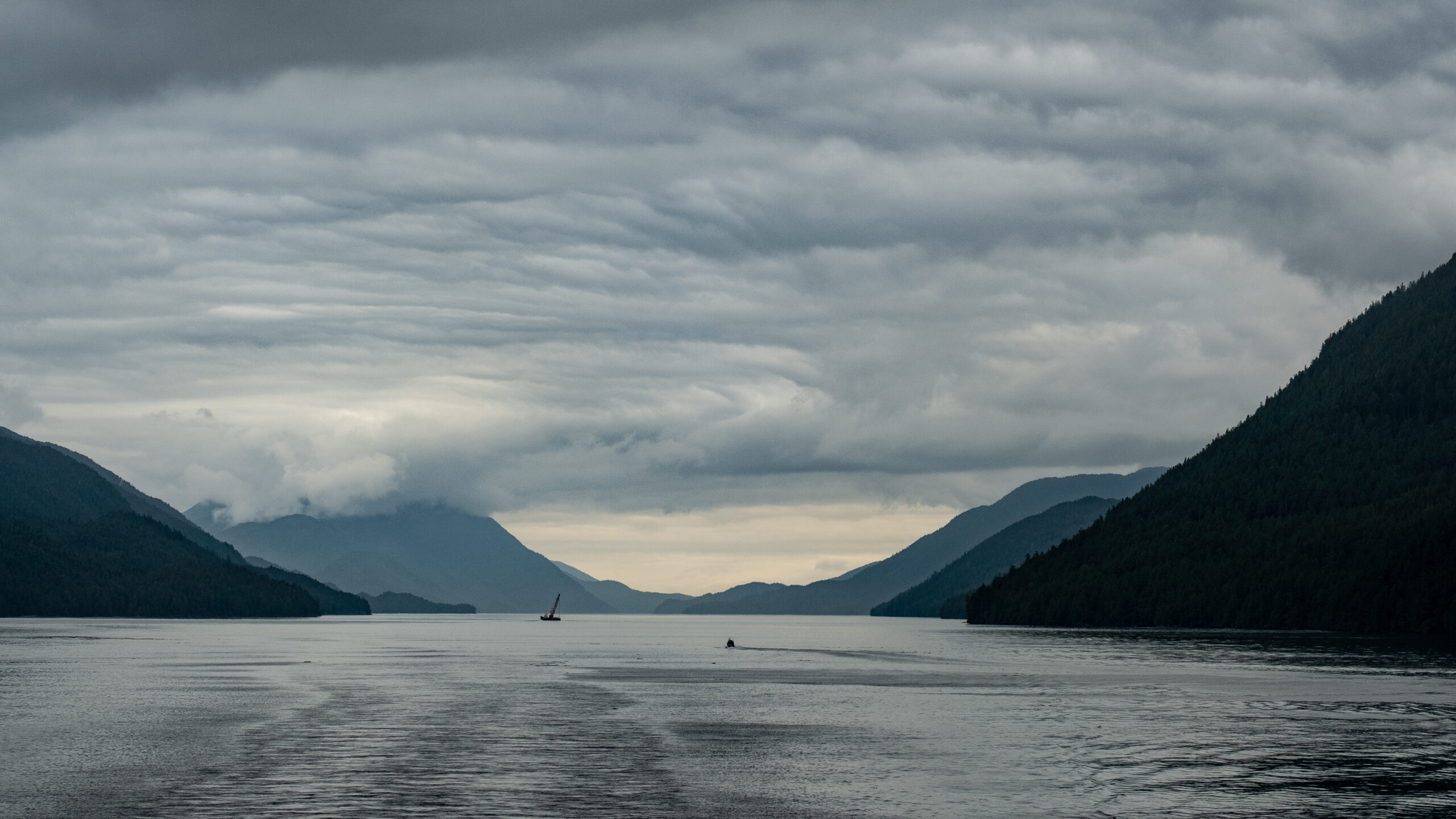
We disembarked the ferry at about midnight. It was a short drive to the hotel in downtown Prince Rupert and it felt good to sleep after our 16 hour sail from Port Hardy.

We were lucky with the weather. A beautiful sunny day to walk to a few sites near downtown. First stop…a Starbucks located in the local Safeway! Then we wandered to Mariner’s Park which overlooks the harbour. There’s many tributes to sailors including the flags of Denmark, Iceland, Norway and Sweden recognizing the Scandinavian influence in the area. I loved the whale’s tail that Craig sat on while he enjoyed his coffee.

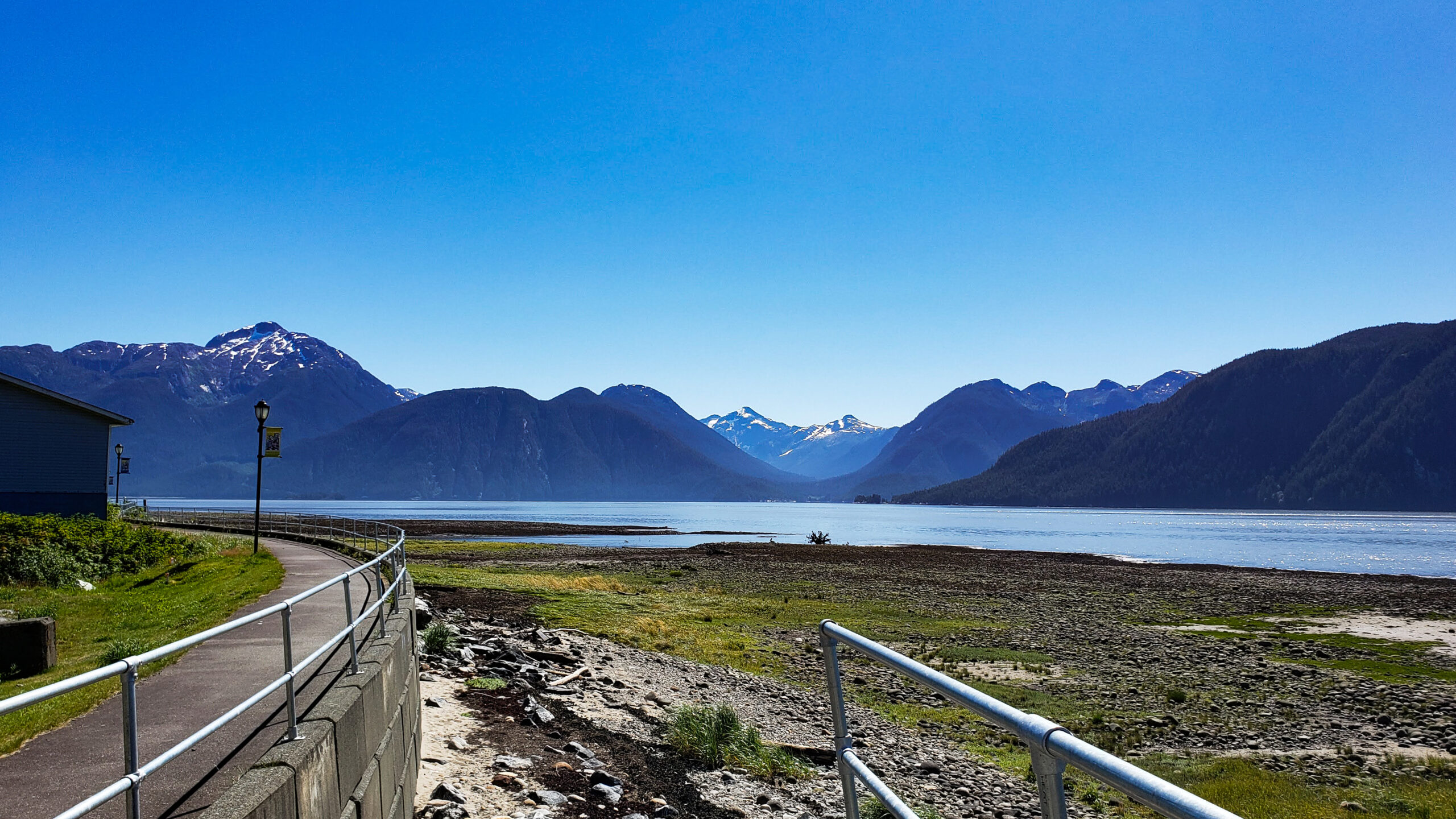
Along the harbour and next to the marina is a fun community called Cow Bay. You can read about the history of Cow Bay in one of the pictures below. The area is full of shops, restaurants, coffee shops and a great looking B&B. We had fun wandering through the shops and the marine museum, had a seafood lunch then saw a group of people on water bikes in the harbour. That looked like fun. Next time…along with many other things that we didn’t see during our 3 hour walk in Prince Rupert.

Back in the car to continue the journey. The drive from Prince Rupert to Terrace is spectacular. We travelled beside the Skeena River, which looked like a large lake in some areas. And the mountains were stunning. It was a pleasant 2 hour drive (we stopped a few times for photos).

We stayed in an AirBNB in Terrace about 10 minutes from the downtown area. It was a lovely house…great kitchen and lots of room. It was our home for two nights. I like Terrace. It’s a young city with a blend new and older houses with big yards. A great place to raise a family…if you can survive the winters!

Craig’s sister-in-law, Louise, was in town visiting her family so she dropped by for a visit. We haven’t seen her for a couple of years.

We spent the next day exploring the Nass Valley, heart of the Nishga’a First Nations. The Nishga’a treaty was the first modern-day treaty in BC negotiated between the Nishga’a nation, Province of British Columbia and Government of Canada and it came into effect in May 2000. The Nisga’a Final Agreement is the first treaty in British Columbia to provide constitutional certainty in respect of an Aboriginal people’s Section 35 right to self-government. It recognizes Nisga’a Lands and opens the door for joint economic initiatives in the development of the Nisga’a Nation’s natural resources. It took over 100 years to come to this agreement.

We headed out of Terrace on Hwy 113 (representative of the 113 years it took to finalize the treaty). Again, a spectacular drive. The mountains around Terrace are impressive. Our goal was to get to the Visitors Centre to understand all the sites to see. We’d heard about the Nisga’a Museum and the four Nisga’a villages along with the impressive lava beds.

The Visitors Centre is located next to the campground in Nisga’a Memorial Lava Bed Park. This is the first provincial park jointly managed by a First Nation and BC Parks. We learned here that most of the “attractions” were closed because of COVID protocols. Disappointing, but we discovered that we could do a self-driving tour to points of interest and the four first-nations villages located in the Nass Valley.

First stop was in Gitlaxt’aamiks (home of people of the ponds). We picked up the auto tour map at the general store. The totems located at community building represent the 4 Pdeek (tribes) of the Nisga’a Nation: Raven, Wolf, Killer Whale and Eagle. This village is considered the capital of the Nisga’a Nation and overlooks the flow of the lava beds that erupted in the 18th Century.

Throughout the park are opportunities to see the lava beds up close. There is a tour that takes you to the lava cone, but wasn’t available during our time there. However, we were able to see several areas of the lava beds. The eruption happened over 266 years ago – Canada’s last volcanic eruption.. 2000 Nisga’a people lost their lives. This park serves as a memorial and a reminder of the importance of respect for both the natural world and the wisdom of the elders.

The next village we visited was Gitwinksihlkw (place of lizards) on the north side of the Nass River. The vehicle bridge is flanked by four totem poles (Eagle, Wolf, Raven and Killer Whale). In the village we were able to access the 400′ suspension bridge which used to be only access to the village. From the bridge, we could see two fish wheels which we think has something to do with fish counting.

Our next stop would have been the hot springs, dwelling place of Sbi Naxnok (supernatural spirit). The sulfur smell of the hot springs is said to be the smell of the spirit. This is a designated heritage site. Unfortunately, like many other places, it was closed due to COVID Next time we are in this area, it will hopefully be open.

The village of Laxgalts’ap (village on village) was built on a series of Nsiga’a communities that occupied this site for milennia. The Nisga’a Museum is located near this village. It houses cultural treasurers from the 19th and 20th centuries. Again, we were unable to see inside due to COVID restrictions.

NIsga’a Museum

We followed Hwy 113 to the very end to visit the fourth village, Ginglox (place of skulls). In the past, invaders where met by Nisga’a defenders to protect their land and resources. Apparently they would display the skulls of the invaders on posts as a warning to others. Today, the village is famous for welcoming visitors from around the world to hike, kayak, boat and sport fish. We met a local man who was taking his child to the community centre. He talked about how the community was blessed with ample food from the sea, and fresh water from the mountains. It is a beautiful place.

Other stops of interest in the Nisga’a Memorial Lava Bed Park that we visited during our 5 hour visit included:

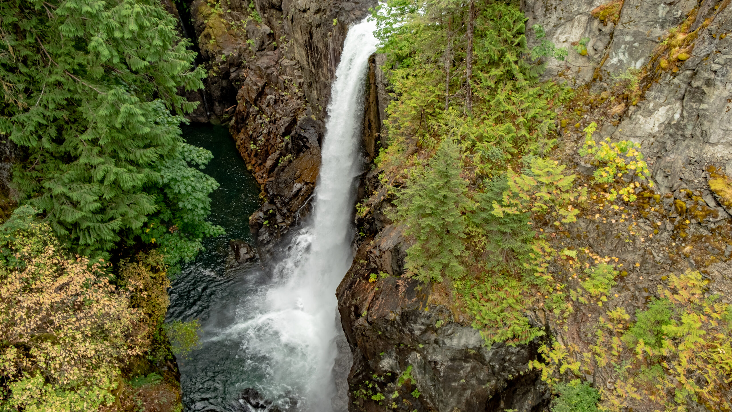
Vetter Falls – just a short walk from the highway. The stream disappears under the lava 5 km downstream and traps fish such as steelhead. Apparently because they are confined to this short stream, they have developed snake-like bodies with large head. Locals call them Phantom Fish. We didn’t see them in the pools, but the falls were beautiful

Drowned Forest – When water levels are high, the Tseax River flows over the land and through the forest. I imagine this is quite the sight during the rainier seasons. It had been pretty dry this summer.

Lava Lake – Thousands of years ago a glacier moved through the valley and created the depression that holds the lake During the lava eruption, molten lava flowed to the creek bed, damming the stream and raising the level of the water by 30 metres. Not sure about the story of the car below but there was a young family enjoying a picnic on the beach. Pretty sure this was their car.

It was a great day spent in a culturally- and scenic-rich area. Highly recommended!

We left Terrace the next day, but not before seeing a site that Craig’s sister-in-law had recommended.

Ferry Island is located along the Skeena River as you head south towards Smithers. There’s a large campground and walking trails around the island. But the big feature is The Spirits of the Forest carved into the cottonwood trees throughout the park. They are the work of artist Rick Goyette. I think we missed a few at the beginning of the walk. We asked another hiker about them, and she gave us some hints. Once you find one, the rest are a little easier to find. I took pictures of about 35 of them, and I’m sure there were more that we missed. I’ve posted some highlights below. Definitely a fun morning walk!

Now on to Smithers. Again, the views were amazing. We stopped for a quick barbequed lunch at a rest stop…that had wifi (that made Craig happy). Then we continued on to Smithers for our next overnight stop.

By the time we got to Smithers, settled into the hotel and decided on where we would have dinner, we didn’t have too much time to explore. We had dinner at a locally-run family restaurant Steakhouse on Main. Craig and I shared a giant steak, and it was cooked beautifully. After dinner, we walked across the street to an ice-cream vendor then walked around the downtown area. Smithers adopted an Alpine theme in the ’70s and Alpine Al became the guardian of Main Street and official mascot of the town. It was quiet on the streets (as evidenced by the empty stage!).

Next day was a long drive to Prince George with a quick stop in Quesnel. Craig spent part of his early childhood here, so we had a quick photo at the water wheel next to the bridge.

Another quick stop in Vanderhoof for a picnic lunch at the Community Museum. The smoke from all the fires burning in BC was noticable.

We spent the night in an AirBNB in Prince George. It was a little cooler and rainier here, so other than a quick stop at Costco to gas up, we didn’t spend any additional time here.

The next day started out rainy, but gradually improved. We headed to Lillooet for our final overnight of this trip. When we turned off Hwy 97 to Hwy 99, we saw the local fire on the side of the mountain. Not close enough to be scary. We stayed at a lovely little AirBNB overlooking the river. Our host, Thyra, was fantastic. She picked fresh plums and grapes from the garden.

We decided to dine at the local winery, Fort Berens Estate Winery. We dined outside with a view of the fire on the mountain top and the firefighting helicopters coming home for the evening. Dinner was lovely, and the wine was good. A nice final evening of our fantastic “northern” trip

Our final stretch home was on Hwy 99 to Pemberton where we stopped at Mile One Eating House for a delicious and very filling late breakfast. Highly recommended if you are in Pemberton. We also picked up some famous Pemberton potatoes to bring home.

The final part of our journey was less than spectacular as we were delayed over an hour through Whistler due to road contruction, then being in the rush hour line-up through West and North Vancouver. It was good to arrive home!

We loved this trip. I feel there was so much more to see, so perhaps a repeat trip to some of these areas is in the cards for the future.

Hope you enjoyed our travel stories!

Cruisin’ the Inside Passage to Northern BC

Continuing the story of our road trip in August 2021…

We had a reservation on BC Ferries to travel from Port Hardy to Prince Rupert. The ferry sailed at 7:30 am; however, because of onboarding procedures (checking ID, etc), passengers are required to be at the terminal 90 – 120 minutes ahead of sailing. So there we were at 5:45am waiting to board. Craig and I were struck by how friendly all the BC Ferries staff were at such an early hour!

Safely boarded, we checked into our stateroom. We decided this was a good investment to have a place to store our belongings including our electric cooler and to have a place to put our feet up during the 16 hour sailing. I was surprised to see it had a TV and a shower!

We travelled on the Northern Expedition. The ferry was clean, didn’t feel crowded, and had lots of comfortable seats. Some of them faced out to the port and starboard so you could watch the scenery go by. Also lots of room to wander the decks outside for bigger views. That’s were I spent most of the journey. People were not allowed to stay in their vehicles or even go to the car decks as it is all enclosed. However, about every 2 – 3 hours, there was an announcement allowing people 15 minutes to go to the car deck to retrieve items, or check on their dogs.


The beginning of the journey is across open water, and there were quite a few queasy people. After about an hour, we entered the Inside Passage where the waters were very calm.


I loved that there were announcements of places of interest as we passed. Lots of lighthouses many of which were built to guide sailors to the Klondike. There was an unsolved murder of a lighthouse keeper on Addenbrooke, and some mysterious disappearances on Egg Island.

The inlets and fjords all along the journey were so picturesque. Although it was cloudy for most of the sailing, the views were still mesmerizing. And because the Inside Passage is so protected, it was quite pleasant to be outside on deck.


We had a stop at Klemtu which is an isolated community on Swindle Island where the main industry is aquaculture. A group of kayakers disembarked here. I was curious to know where they were going. This area is surrounded by the Great Bear Rainforest. I’m sure the kayakers would be seeing some amazing sites.

Further along, the sun came out for a while as we approached and passed by Bella Bella and Shearwater. Many years ago, Craig did a consulting gig at Shearwater!


I can help but post more pictures of amazing scenery along all of the Inside Passage!

One of the most picturesque lighthouses was at Boat Bluff where the inside passage starts to become very narrow. It was at this point that I actually saw a whale…I am pretty sure it was a Minke whale. Didn’t capture any pictures, except one that showed it blowing water!

The next photos really show how narrow the passage gets. The fog rolled in and the fog horn was blasting for quite a long way. The views were quite magical.

So glad that we took advantage of this BC Ferries trip. It is likely the only “cruise” I will ever go on!

Stay tuned for the last chapter of this road trip in the next blog…Prince Rupert, Terrace, Nass Valley, Smithers and Lillooet.

Exploring Northern Vancouver Island

Many people love to visit the Okanagan, Whistler and Southern Vancouver Island. I love these areas as well. This summer, we decided to take a less travelled route to see parts of BC that I had never seen before. Craig has been to most of these places…but not for many, many years. He was interested in seeing Northern Vancouver Island where he visited his grandparents when he was a young child.

We booked much of our trip with BC Ferries Vacations. This experience was very positive. We were able to customize the trip to allow us more time in some areas and less in others. I booked additional accommodation through AirBNB.

We hopped on the Vancouver-Nanaimo ferry early on a Saturday morning with the reservation that was part of the package. On the Island, we travelled directly to Parksville, and stopped for a coffee, then continued on the Ocean Road…such beautiful views and leisurely drive. In Courtney, we stopped for lunch at a unique little family-run restaurant called Plates. True to its name, there are license plates from all over on the walls. Food and service was good.

Campbell River

We arrived at our destination for the night in Campbell River and settled in at the hotel after watching a parade (it was blocking access to our hotel). Those who know me, know I like to walk. I left Craig in the room and after asking some advice from the woman at the front desk, I headed out to walk along the marina with camera in hand. I didn’t pay too much attention to the dark clouds that were fast approaching until the thunder and lightning started, then the torrential downpour. I found shelter at a building with a large overhang. After about 20 minutes when it didn’t look like it was going to stop, I made a run for Moxies a couple of doors away. I was soaked to the skin! Decided to wait out the storm with a glass of wine and messaged Craig to let him know I was OK. Continued my walk (back to the hotel after about another 30 minutes, snapping some shots along the way.

On another trip, I would love to spend more time in and around Campbell River.

Elk Falls

The next day, we continued our trip to Port Hardy. About 20 minutes out of Campbell River is a fantastic provincial park with a suspension bridge right beside the thundering 25 metre falls. I can be a little afraid of heights, but I made it across and back and across again halfway to take some more photos. The park has a number of walking trails through old-growth forest. It is beautiful and peaceful.

Proof that I crossed the bridge!

Coal Harbour

Craig’s grandparents lived in Port McNeill and he visited the area as a child. We went to Coal Harbour on our way to Port Hardy. Craig remembers visiting this area when there was still whaling happening in the harbour. Thankfully, that practice was discontinued in the 1960’s.

During WWII, the RCAF used this area as a base for seaplanes patrolling the Pacific. A big hangar remains and houses a museum that apparently features a 20 foot jawbone of a blue whale. Unfortuantely, we didn’t venture inside the hangar. These days, Coal Harbour is a mecca for sports fishing.

View of Coal Harbour from the pier
Old pontoons from Float Planes
Quatsino First Nations totem overlooking the docks

Port Hardy

We stayed two nights in Port Hardy to facilitate some further exploration, and also to be close to the BC Ferries for our trip to Prince Rupert. We walked along the waterfront, had fish and chips at a local food truck and met one of the hereditary chiefs of the Kwakiutl First Nations. He had just created music for his son to sing at an upcoming event. We also had great accommodation at the Kwa’lilas Hotel, a lovely First Nations destination hotel.

There is much more to explore in Port Hardy; however, we focused our attention on Telegraph Cove and Alert Bay on the full day that we were in the area.

Our final night, we had Sushi from Karai Sushi and Grill near the Port Hardy airport. It came highly recommended by a young man working at the Tourist Info office in Port MacNeil. It was very fresh and tasty! We understand that they will be opening another restaurant in downtown Port Hardy in the near future.

Telegraph Cove

The focus of our full day in the area was on Alert Bay, but we made time to visit the picturesque Telegraph Cove in the morning. This community sprung from a one-room telegraph shack where fishermen, loggers and pioneers could keep in touch with the outside world. The community grew to include a fish saltery, sawmill, school and general store. Many of the buildings are built on stilts along the rocky shoreline. As we wandered through the colouful community, we read about the history of the various buildings many of which are cabins for rent. This is a centre for eco-tourism for Johnstone Strait and the Broughton Archipeligo. We didn’t have time for a tour, this time. Definitely on the list to come back to and stay for a few days.

We enjoyed an Americano at The Cove Coffee Company. The owner/barista made sure to understand how we liked our coffee. Craig had one of their famous cinnamon buns (with raisins) and I had a scone. All delicious and filled us up for our ferry ride to Alert Bay.

Alert Bay

We arrived in Port McNeill a little ahead of the 11:30am sailing so we had a peek in the Tourism Centre. Craig was hoping to see some old photos from the 1960’s as his grandparents lived here then. Unfortunately, the historian had retired and no photos were available to view.

Alert Bay is located on Cormorant Island and the ferry took about 45 minutes. The island is only 4 1/2 miles long and about 1 mile wide. Upon arrival we walked to the Tourist office to get directions to the Anglican cemetery where Craig thought his grandfather was buried. The woman there let us know that it was walkable, but there was a big hill to walk up. We walked along the main street boardwalk and had a look inside the Anglican Church. Then we found the path we needed to take. It was a hill…but only took about 10 minutes to get to the top.

The cemetery is quite overgrown, and had a majestic totem on the upper section ((Thunderbird, Killer Whale, Wolf). Craig and I searched the entire cemetery for a headstone of John Hunter Murchie, but with no success. Some plots appeared to have no headstone and others were so worn, it was impossible to see any lettering. Disappointing but not unexpected.

We had about an hour left before the ferry back to Port McNeill departed, so we walked down the hill through a residential area toward the U’mista Cultural Centre. We we were too late for the Kwok’Wala presentation explaining the history of outlawing ceremony potlaches in 1894 by the Government of Canada and the confiscation of ceremonial regalia and art work. U’mista’s purpose is to repatriate those artifacts.

Along the beach on our way to U’mista, we met Fred who was logging a driftwood cedar tree for shakes and for large pieces that he would have carved. Alert Bay is famous for indigenous carvers. We learned about his upbringing at Alert Bay, about the residential school that existed until the 1970’s, his moving away, and now returning to Alert Bay…or more specifically to ‘Namgis First Nation. He also told us who to reach out to for information on where Craig’s grandfathers grave is located.

The walk back to the ferry dock was pleasant. We spoke with many locals. Everyone was kind and welcoming. Next time, spending more time in the cultural centre and viewing more of the amazing totems on the island is in order.

Ferry from Port McNeill
Approaching Alert Bay
Amazing artwork everywhere
Craig searching for John Hunter Murchie’s gravestone
Totem at the Anglican Cemetery
Fred…a man with many stories
U’Mista Cultural Centre
One of many totems displayed at private residences

More of our travels to come…

Watch for the next installation of our travels – Port Hardy to Prince Rupert and beyond.

Vancouver Island – Sooke to Port Renfrew

Westcoast Hwy Sooke to Port Renfrew – so much to see and enjoy. Here’s an overview of our 4 days.

July 2021

Craving a get-away now that travel is allowed, we chose to take advantage of the BC Ferries Vacation package to Sooke, BC. It is great to explore a new (to me) area of Vancouver Island.

We arrived at Tsawwassen Ferry Terminal early, so we were able to just barely fit on an earlier sailing. Sailing was smooth and sunny.

Since we were too early to check into our hotel, we had lunch at Route 14 Bistro. Great food, friendly service. Then it was off to the tourist info centre to gather some information about the Sooke Potholes.

It’s a short drive to the area. We chose to follow the Galloping Goose Trail (from Parking Lot 3) to the Todd Creek Trestle. It has recently been restored. The rock formation was interesting. I saw a puffin face…maybe you’ll see something else!

We wandered back up the hill on the river side to catch some views of the potholes. The young people on the rocks below were enjoying the day (and I’m pretty sure had climbed over a tall chain link fence to get to this section of the river). The potholes are a popular place during the hot summer weather.

We stayed at the Prestige Resort on the harbour. Our room was ocean-facing, with a large balcony to take in the sights. I loved sitting out there in the morning with my coffee, watching the seals, deer and fishermen launching their boats. It was quite entertaining! The coffee bar served great coffees and we enjoyed a breakfast and dinner in the restaurant. Excellent meals.

We spent the next two days exploring the coast along Highway 14 between Sooke and Port Renfrew. Here’s some of the highlights.

Whiffen Spit (5 minutes from Sooke)

It’s a short flat walk, popular with dog-walkers and locals. Lots of driftwood and amazing views of Sooke Harbour and the Straight of Juan de Fuca. Apparently this is a great place to storm watch!

Shirley (about 15 minutes from Sooke)

Three things about Shirley, and two of them are food-related. For excellent breakfasts, coffee, pastries (and I am sure other food), this is the place. It’s very popular! And just down the road is Stoked for wood fired pizza. Can personally attest that both are excellent.

If you follow the road behind Shirley Delicous, you can access the lighthouse at Sheringham Point. This part of the Strait of Juan de Fuca has seen hundreds of shipwrecks in the 19th and 20th centuries. It is know as the “graveyard of the Pacific”. The lighthouse has recently been refurbished. Beautiful views of the Strait of Juan de Fuca and the Olympic Peninsula. It’s a short walk downhill to the lighthouse.

Beaches along Hwy 14th

So many beaches! We picked 4 to visit during two drives to Port Renfrew, once for a day trip and another on our final day continuing to Lake Cowichan, Duncan and finally Swartz Bay after a visit to the Malahat Skywalk – more on that later.

Sandcut Beach (Jordan River)

Small parking lot, but you can park on the side of the road. A beautiful short walk through the trees where you come out to a 3.5 km stone and pebble beach. Heading left, you will find a sandstone wall with one or two waterfalls. We were there during the hot weather, so the falls were small. Further along in the sandstone walls, many smooth, flat beach rocks have been placed and stacked, making an interesting mural. A great beach for families…and dogs!

China Beach

In my opinion, this is the most beautiful beach along Hwy 14. Lots of sand and would be great to make sandcastles. At the north end of the beach you can walk a trail to Mystic Beach (part of the San Juan Trail system). The trail down from the parking lot has some steep stairs towards the end, so if you have bad knees, just take it slow. There’s a campsite on the north end of the beach.

Sombrio Beach

We missed the turn-off on the way to Port Renfrew, but found it on the way back to Sooke. It’s a Forest Service Road with lots of potholes on the way down. It’s probably only a km to the parking lot, but it felt much longer to us! The trail to the beach felt longer than the posted distance of 1/2 km. Where the trail branched, we took the path to the right and walked over a suspension bridge. The trail from there was narrow and a little rooty, but manageable. The beach was quite rocky at that end. I understand the path to the right leads to a sandier beach and that part is popular with surfers – in the fall, winter and spring. I thought we might see some! There are two rustic campgrounds at Sombrio which seem to be quite popular.

Botanical Beach (Port Renfrew)

Miles and miles of tidal pools to be explored at low tide. I think we went to the wrong bay first…it was a little more difficult walking on the rocks. However the cool forest trail between the two beaches was amazing. Definitely on the list to come back to and spend a good portion of the day.

Port Renfrew

We had a great lunch at the Port Renfrew Pub – rock cod and chips. I had a local beer and Craig was surprised to see his favourite no-alcohol beer, Partake which is brewed in Ontario. A short walk on the pier afterwards where we found some amusing COVID signs and some great little cottages right on the beach. That info was filed away for future reference.

Fairy Lake

I have seen many pictures of a bonsai-like tree growing out of a small lake just outside of Port Renfrew. On our drive through on our last day on the Island, we found it. Here’s a couple of shots, one showing the lovely beach in the background and one edited for drama. The campground and beach is a popular place during the summer.

Other Island Adventures

Craig participated in quite a bit of walking (which I love to do). On the beaches, through forested trails, up and down hills. I asked him what he would like to do during our 4 days. He had three requests: whale watching, ziplining and the Malahat Skywalk. I think he was quite surprised when I booked a zipling afternoon. I do have a fear of heights at times.

Adrena Line Ziplining (Sooke)

Have to admit, I wondered what I was getting myself in to.

We joined two families with young kids and headed up the hill. The first one was pretty good. I thought to myself, I can handle this! Little did I know that it was a practice run. There were 8 ziplines and one suspension bridge and it was a blast. Only one time was I scared. One of the platforms was on a very tall tree swaying in the wind. Then other trees started swaying and a little bit of vertigo set in. I hugged the tree (and got pitch all over me). I greatly enjoyed the day…and the beer at the pub next door to the Adrena Line office after! Our guides were amazing! Highly recommended as an activity in Sooke. Adrena Line

Malahat Skywalk

This newly-opened attraction is located between Duncan and Victoria on the Malahat Hwy. It can be a little tricky as there are no left turns to the facility. Pay attention to the directive signs to use the designated U-turns depending on which direction you are coming from.

This is quite the architectural structure. From the ticket booth, you walk along the skywalk amongst the tree tops where you see the beautiful arbutus trees. The structure itself is easily walkable with a gentle slope. And the views are beautiful – in all directions. The top of the structure is 250m above sea level. The structure itself is 35m tall.

At the top you can bounce on the Adventure Net (if you want). I declined this feature and chose to drink in the scenery instead. Craig did some jumping.

You have three choices to get down… walk down the same way you walked up, walk down the metal spiral staircase in the middle, or take the 165m slide. I meandered my way down and Craig chose the slide (it was about a 20 minute wait).

Certainly an enjoyable experience. For any who would like to do this more than once in a year, the annual membership is definitely worth it.

Post Trip View

Such a fun 4 days. We were very happy with booking the trip through BC Ferries Vacations, and there are many other options for accommodations in and around Sooke including dozens of B&B’s and AirBnb’s. Hope to return for further exploration in the future…maybe some storm watching!

Looking forward to our next adventure – Campbell River, Port Hardy, ferry to Prince Rupert, Terrace, Smithers and more…