After another hearty breakfast at Homewood Suites, we were in the van again just after 7 am, heading out Hwy 70 towards Hwy 24. There will be two stops on our tour today. Goblin Valley State Park and Capitol Reef National Park.
Goblin Valley State Park
I didn’t know much about this park before our arrival. Geologically speaking, the goblins in the park were formed by the gradual erosion of Entrada sandstone (from about 170 million years ago) when the area was a tidal flat next to an ancient sea. With the tides, the sand washed-in, eroding the hoodoos and depositing silt and clay. Weathering wore down the different layers, smoothing out sharp corners. Aided by decomposition and erosion the rounded caps and curves of the “goblins” were formed.
When you first see this area, it feels like you have landed on Mars! There are no defined trails here – people can wander around the 3 square miles of the main attraction filled with thousands of hoodoos.
Joe challenged us to come up with a name for the area, or for specific hoodoos. We spent the next 45 minutes inspiring our imaginations. As we gathered for a group shot, Joe announced that Barb won the challenge with her name of “Smurfville”. Not sure what the prize was. 🙂

Three Sisters guarding the park 
Like Mars or Smurfville! 
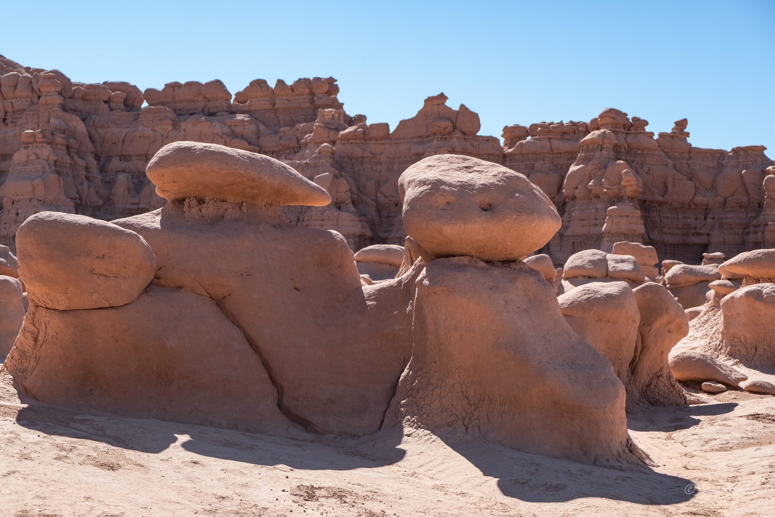
The tall hoodoos will eventually be like the smaller ones 

Toadstool Alley 
Could be gnome homes… 
Pouting turtle 
What do you see? 
Bird on a doggie 
Let me get the right framing… 
Gathering of the Goblins 
Our travel group 
Capitol Reef National Park
We continued on Hwy 24 to Capitol Reef National Park. This is the least visited of the Mighty 5 but has an interesting geology. It’s a 100 mile long warp in the earth’s crust, known as the Waterpocket fold. This describes the “reef” part of the name. Like a giant barrier in the ocean (think Great Barrier Reef). The Capitol part of the name describes the dome-like formations, similar to state capitol buildings.
On arrival, we drove through the historic district of Fuita past the schoolhouse and the fruit orchards. Visitors are allowed to pick fruit from the trees in season. Gifford House sells famous fruit pies (although we didn’t taste them). We had a quick visit of the Visitor’s Centre then proceeded to a beautiful, shady picnic area where we lunched on excellent sandwiches/wraps provided by Sweet Cravings (where we had lunch the previous day). We were surrounded by beautiful old cottonwood trees, and a few mule deer who were probably wishing for a handout.


Old Cottonwood
After lunch, Joe drove us to the trailhead for the Grand Wash Trail for this day’s hike. This is a famous gorge that cuts through the upper portion of the waterpocket fold of the park. The steep canyon walls, made me feel pretty small. It was a hot day, with heat radiating off the walls but once we reached the narrows it was quite shady. Then it was back to blazing sun for the last 15 minutes as we approached the parking lot where Joe was picking us up.


On the way out of the park, we had a final stop at Gooseneck Overlook and Sunset point. Aiden stepped across the “abyss” at Gooseneck. The short walk up the Sunset point trail provided some great panorama views.


Gooseneck Point Overlook 
Aiden stepping over the abyss 
Sunset Point Trail 
Sunset Point
It was a short drive to our next accommodation at Capitol Reef Resort in Torrey. Although it is an interesting property (you can stay in a teepee or Conestoga wagon), the rooms were quite dated, and the air-conditioning didn’t work for some rooms. The views were beautiful though.
Because there was a large tour group at the resort, the restaurant on the property could not accommodate us for dinner. Turned out they couldn’t provide a timely breakfast for us in the morning either. Wouldn’t recommend this property. Definitely would recommend the Rim Rock Restaurant across the street for dinner.

View from Rim Rock Restaurant 
Teepee Accommodation 
Morning Light – Torrey 
Evening Glow – view from hotel 
Sunsetting
Up Next: Day 4 – Boulder Mountain Pass, Singing Canyon, Escalante, Bryce Canyon.